I wasn’t expecting things to deteriorate quite as quickly as they have today.

Just in case readers aren’t familiar with this Air Quality Index scale, readings are based on several factors but the figure 248 refers to parts per million of particles 2.5 microns in size. These have a capacity to enter the lungs and remain deep inside.

So, where is all this smoke haze coming from today.
First, here is yesterdays wind map showing hotspots in the ASEAN region. There are two in Sumatra.

Here is a map showing palm oil plantations and peat domes in Sumatra.
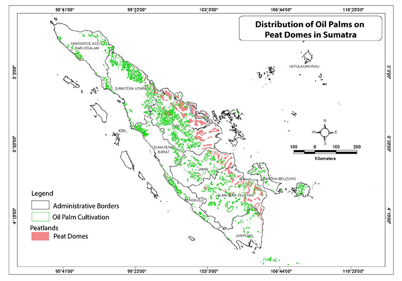
Without doing a precise mapping exercise to match the active hotspots with peat domes, it’s still obvious that the most likely source of Singapore’s smoke haze pollution right now is a hot spot west south west of Palembang. At the time of writing Palembang is at AQI 54 but this is a PM 10 reading
Indonesia’s hot spots
The Straits Times recently carried this video from Reuters
Today the Straits Times carried this article.


Leave a comment