In Early December I posted an initial outline of an action research project I’ve been working on.
The project addresses that part of the NSW Stage 5 Geography Syllabus in which Students learn about geographical issues affecting Australian environments. There’s a variety of possible areas of study, and students must cover two of these. At my school students learn about coastal management and urban growth and decline. We’re already well advanced in our study of coastal management, this is a recurring issue in the eyes of the public and as case in point we’ve had several matters in the news quite recently, namely the plans to sink exHMAS Adelaide off Avoca, addressed elsewhere in this blog and the grounding of the Shen Neng 1 (深能一号)
Urban growth and decline
In week two of the new term we move onto urban growth and decline. This topic addresses the four urban processes illustrated in the images below.

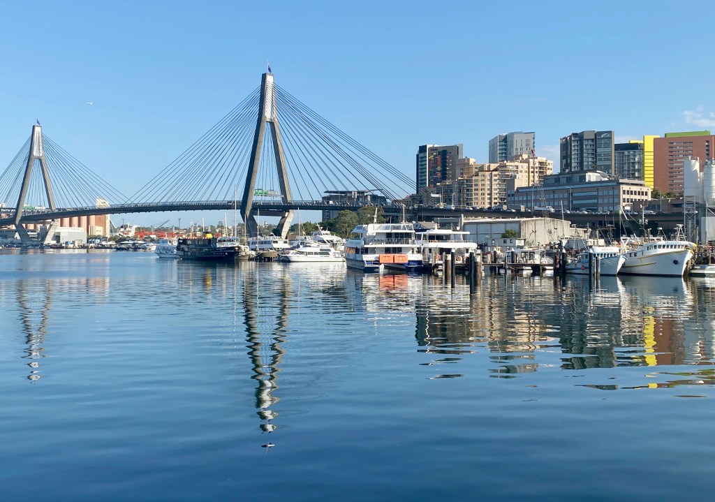
The study begins in the local area and by exploring some models of urban development, then it focuses on the area of Darling Harbour, Barangaroo, Millers Pt, Walsh Bay and Circular Quay.

Here there are several research questions to be addressed:
- How is the Foreshore being used?
- How has the land use changed and what is the impact on the biophysical and built environment?
- What issues have arisen from Urban Growth & Decline?
- Who is affected by these issues?
- How are the issues being addressed?
Background work for this project has actually been in progress since last year and has involved basic work with students on the ABS website. It’s also involved some elementary work using Photoshop to produce choropleth maps from existing map outlines and the editing of maps from the Sydney Social Atlas. Students have also been introduced to the use of Adobe Portfolio for the presentation of documents and have been involved in ongoing use of OneNote as a digital notebook and as a tool for producing a multimedia resources.
A Delicious data base has been constructed using a common set of tags including – stage_5 geography urban urban_processes urban_renewal urban_decline urban_consolidation gentrification barangaroo video_clips. This makes bookmarked sites easy to find and establishes their relevance to particular areas of the study with ease. Most colleagues and a large number of my own students are part of my Delicious bookmark network.

A Blog, SSC Leichhardt Geography Blog has been established. I’m most grateful to Adrian Shipp who’s allowed me to use a most effective image, that he shot from a domestic flight arriving in Sydney, as the banner for the Blog. SSC Leichhardt Geog Blog is an edublogs.org Blog. It was established before blogED was available and I’ll keep running with it. Principally this Blog is for students to post questions and also for me to post articles, photographs, videos and PowerPoint presentations.
Differentiating the curriculum
Since I’m working with a comprehensive student group, course materials will be presented in one of three ways,
- printed documents and PowerPoint presentations for use in class;
- a basic set of documents, images and video clips for the school’s Moodle site; and,
- PowerPoints, posts, images, maps and video-clips on the Blog site.
Using this approach there is inbuilt differentiation of the curriculum, in that students can choose their own level of involvement.
Student research
This unit of work culminates in a basic research project in which students will:
- Identify a research purpose and/or question.
- Develop questions to be investigation.
- Make a decision about appropriate primary and secondary data to be used.
- Organise tools and develop techniques to collect the data.
- Collect the data.
- Process and analyse the data.
- Communicate research findings.
- Consider and propose action where appropriate.
ICT Skills in the Geography Curriculum
The Geography (Mandatory) Stage 5 requires students to develop skills in the use of information and communication technologies and lists six areas in which they are to develop competencies. Prior to the implementation of the Digital Education Revolution, it’s no doubt been difficult for schools to attainment of all of these areas of competence. The digital competencies are listed in the Stage 5 Geography syllabus (page11). In the interests of not infringing NSW Board of Studies copyright, here is the relevant section re-phrased:
- creating a document using ICT that communicates geographical information
- designing and creating a database
- Using various applications to import data into research
- communicating geographical information using presentation software that includes other media
- develop a critical analysis of the veracity and ethics of websites
- find, gather and interpret electronic information.
The project addresses all of these points.
The Wiki and ongoing student collaboration
The final communication of research findings will employ a Wiki. There will be a team of students responsible for this and the intention is that it becomes an ongoing source of information on this unit of work that can be used by students from subsequent years, both as a model for their own field and research work, and also as a tool for longitudinal evaluation of the changing nature of urban processes in the study area.
I’ll write about each of the phases of the project in more detail, highlighting the digital competencies engaged and commenting on the use of Web2.o tools.
The project stages in overview
The following images offer a project overview.


The Blog that developed during this research project has been recycled and reused as a general Blog addressing the Stage 5 Year 10 Geography course in NSW. To visit the Blog follow this link.


Leave a reply to Sydney Urban Growth and Decline: Student observations updated « Maximos' Blog Cancel reply